
[NEW] Updated seismicity in the year 2019 can be seen and routinely updated on my Twitter post:
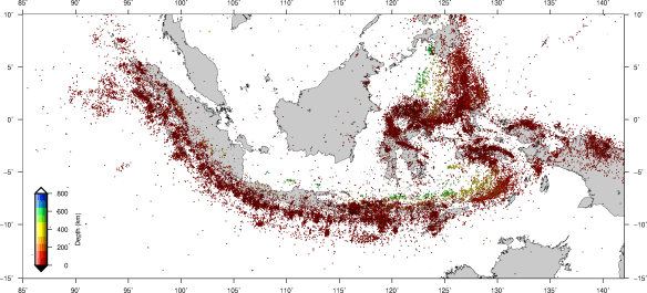
[NEW] Update the map (epicenters of earthquakes 2009-2018):
The full resolution Pdf file: download here: Click to download (3.9 MB)
GeoMapApp version: Click to download (22.6 MB)
…
BMKG Catalog for Significant Earthquakes up to 2009 (old version): Download Here
BMKG Catalog for Significant Earthquakes up to 2017: Download Here
BMKG Catalog for Tsunami up to 2017: Version 1 (Download), Version 2 (Download)
…
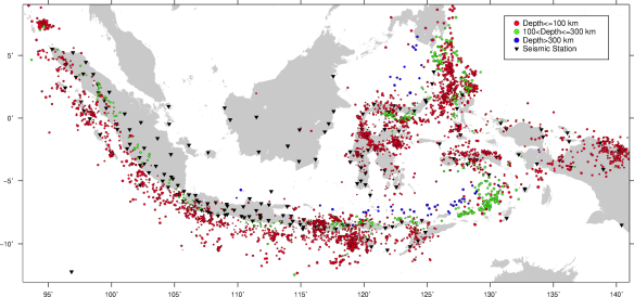
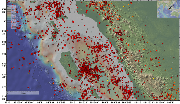
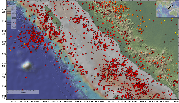
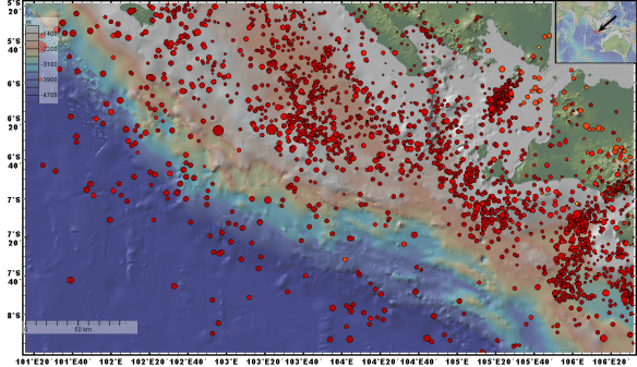
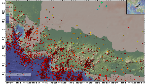
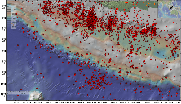
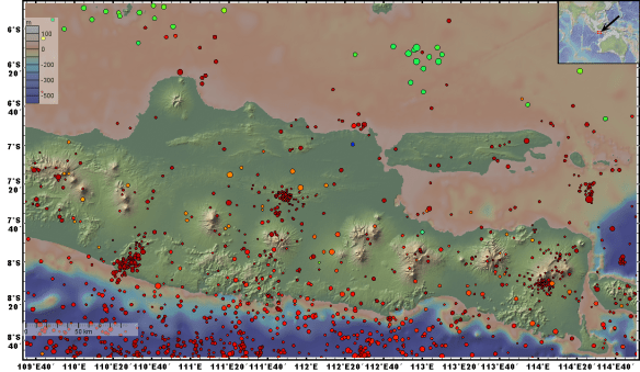
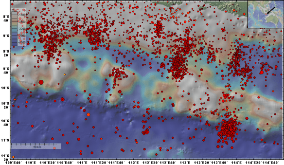
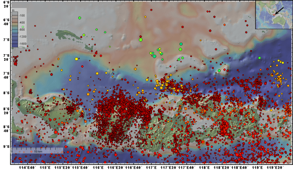
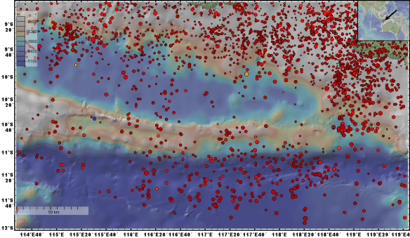
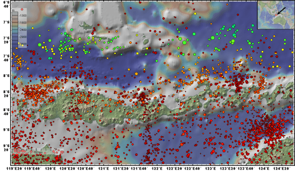
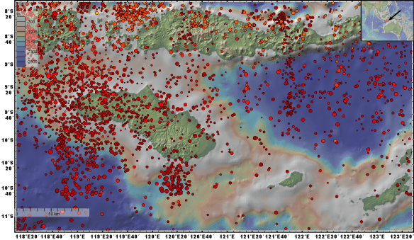
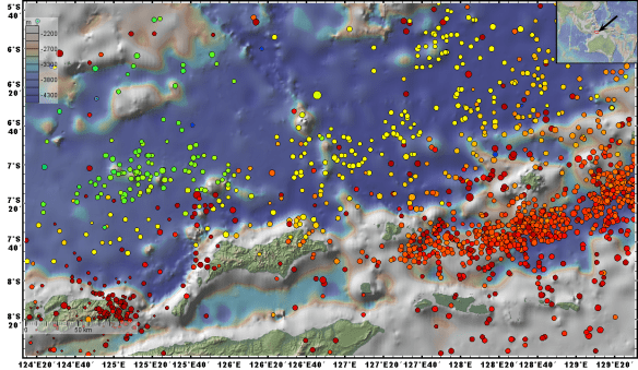
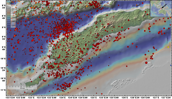
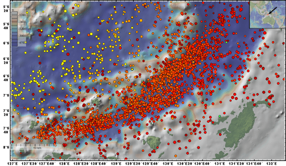
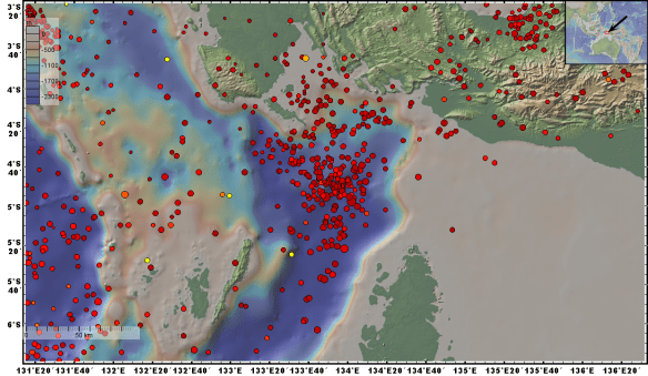
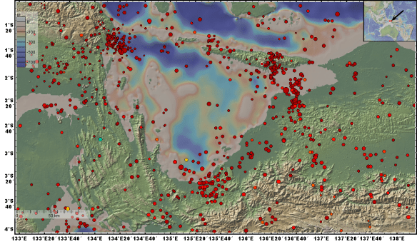
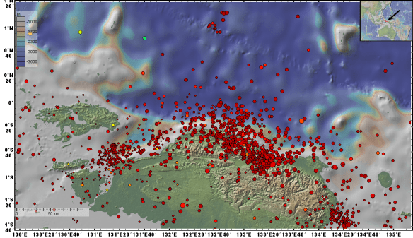
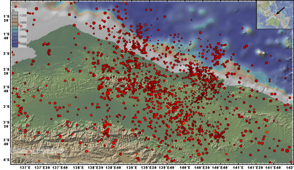
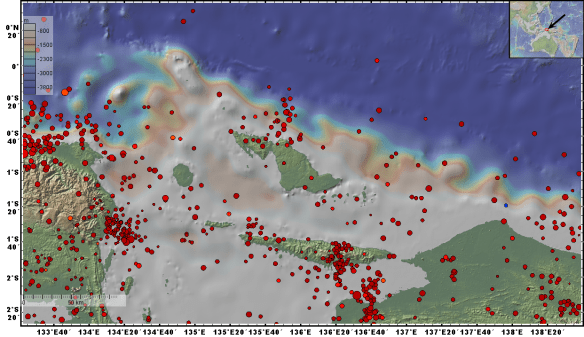
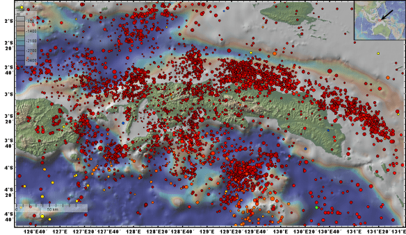
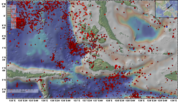
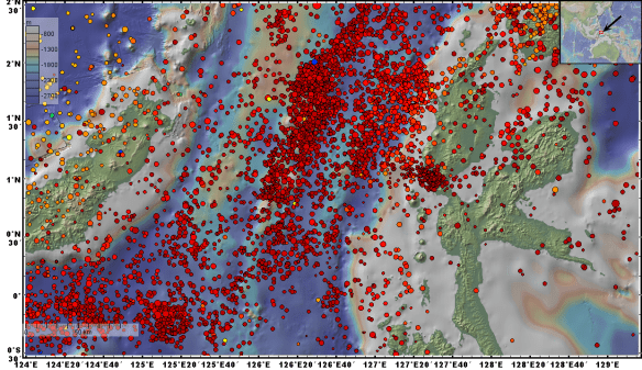
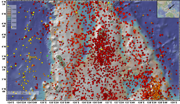
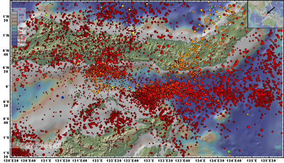
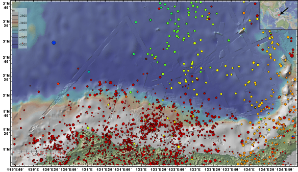
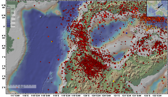
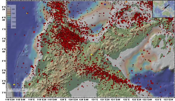
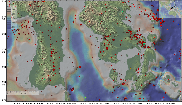
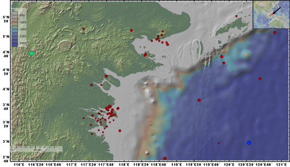
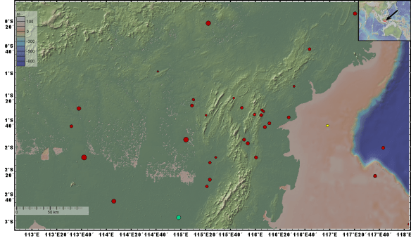
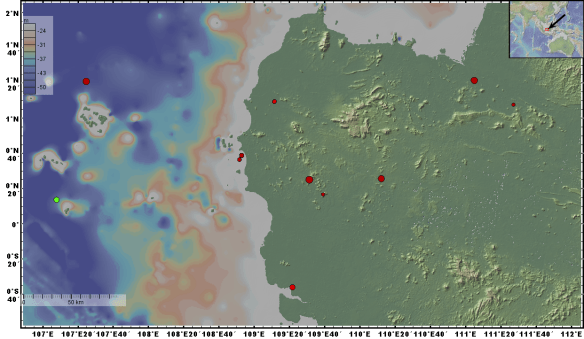
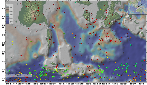
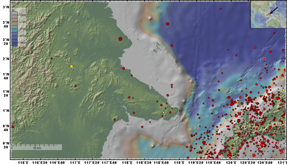
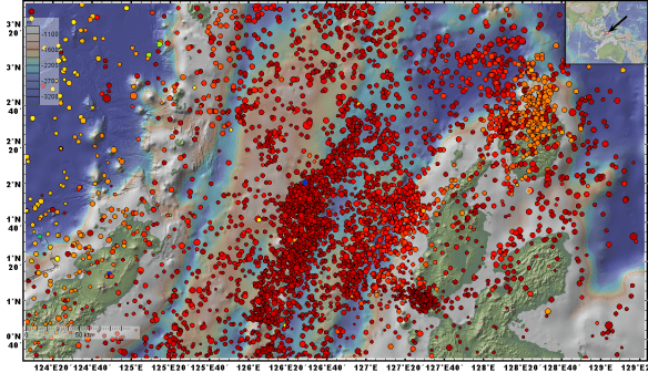
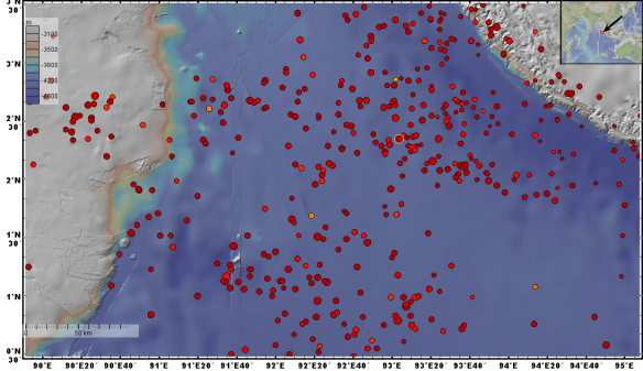
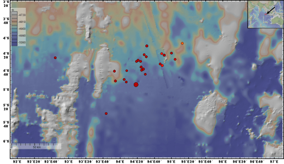
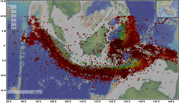
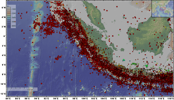
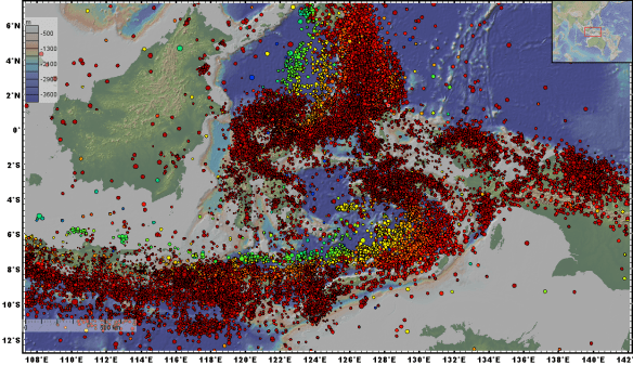
Map showing non-relocated epicenters of earthquakes in Indonesia region in the period of 1 January 2009 – 12 October 2018 (almost 10 years)
Source: BMKG National Earthquake Catalog (www.bmkg.go.id)
01
02
03
04
05
06
07
08
09
10
11
12
13
14
15
16
17
18
19
20
21
22
23
24
25
26
27
28
29
30
31
32
33
34
35
36
37
38
39
40
41
Acknowledgments:
The earthquake parameter data came from The Agency for Meteorology Climatology and Geophysics of the Republic of Indonesia (BMKG). Figures were made by GeoMappApp (http://www.geomapapp.org/) by using the Global Multi-Resolution Topography (GMRT) Synthesis (Ryan et al., 2009).
References:
Ryan, W.B.F., S.M. Carbotte, J.O. Coplan, S. O’Hara, A. Melkonian, R. Arko, R.A. Weissel, V. Ferrini, A. Goodwillie, F. Nitsche, J. Bonczkowski, and R. Zemsky (2009), Global Multi-Resolution Topography synthesis, Geochem. Geophys. Geosyst., 10, Q03014, doi:10.1029/2008GC002332.
